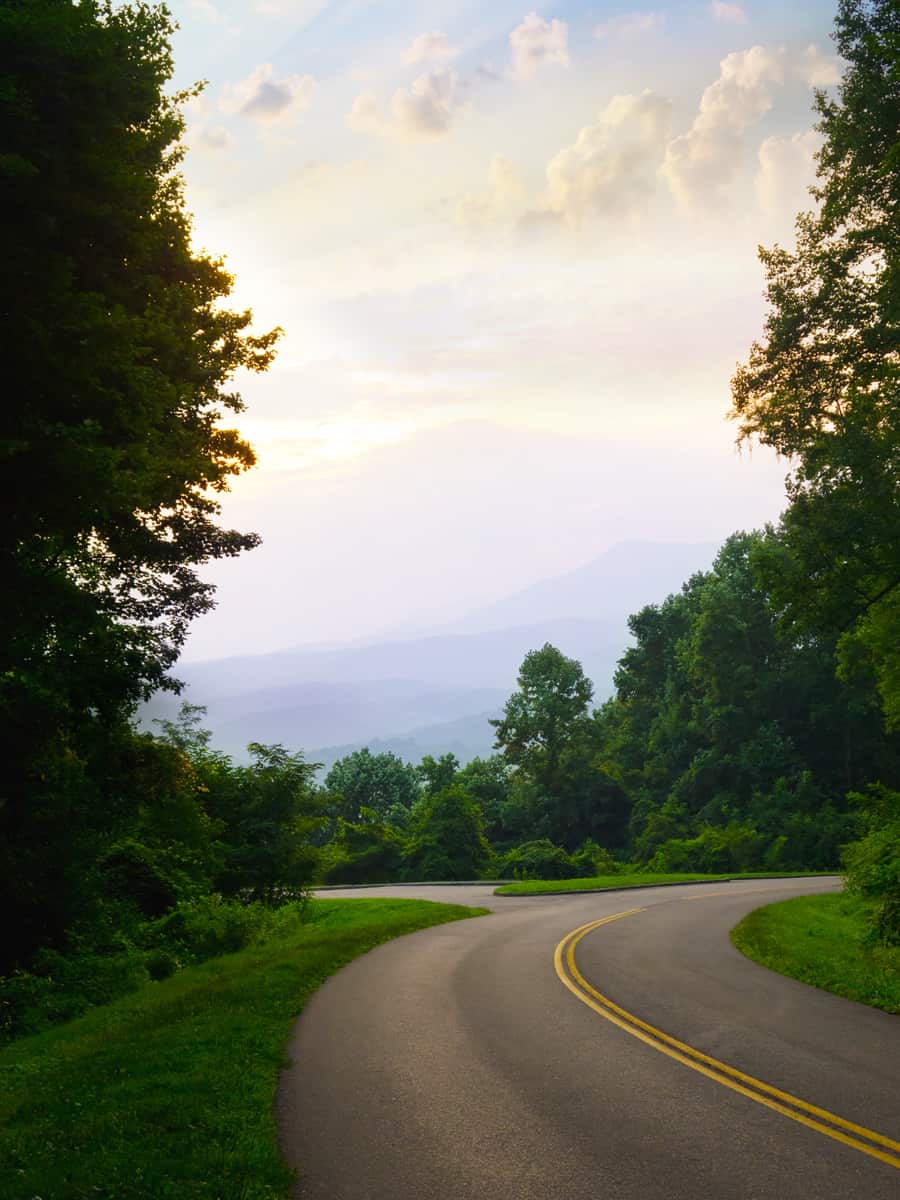
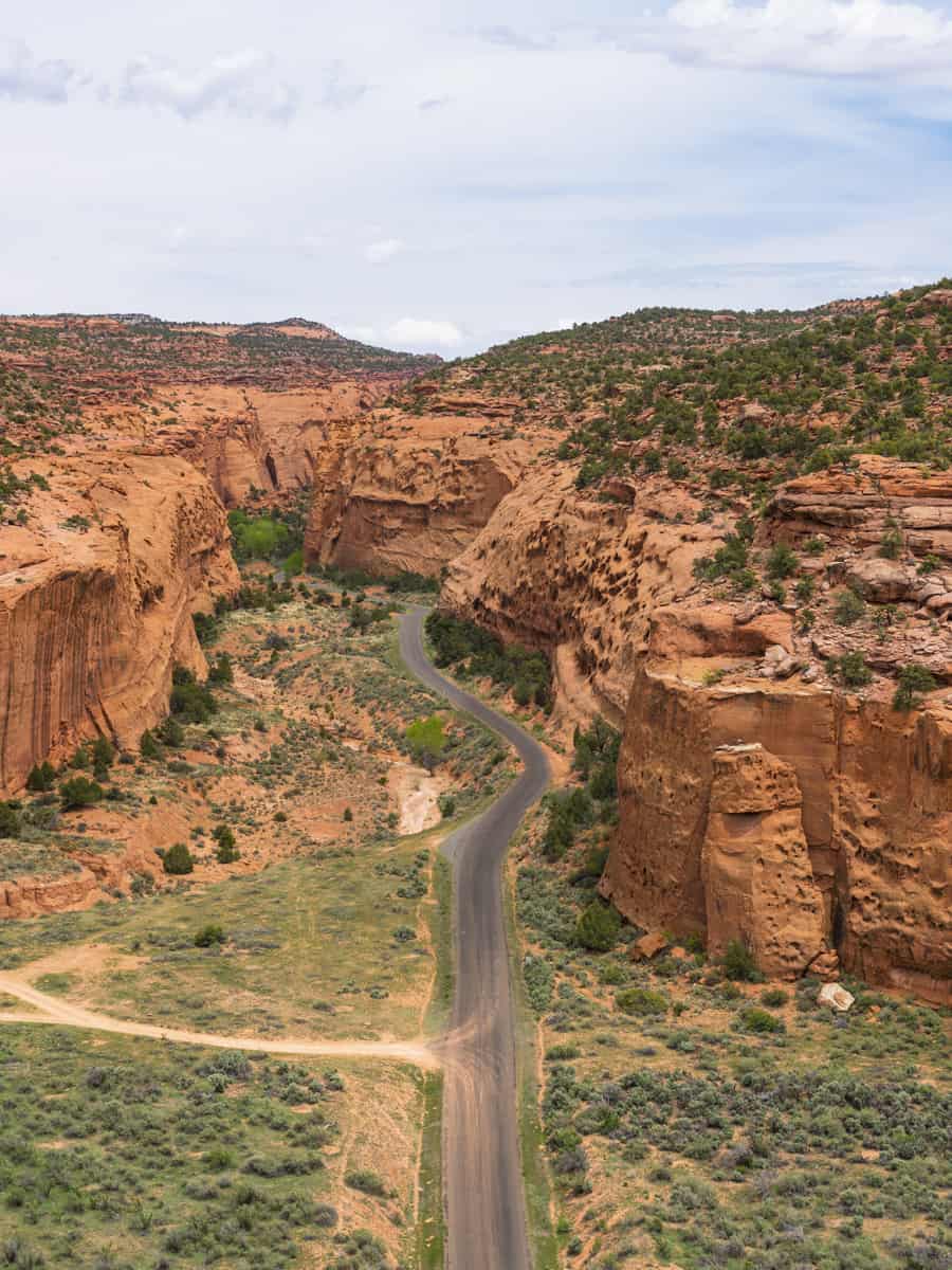
Utah's Scenic Byway 12 offers a breathtaking journey through some of the most diverse and stunning landscapes in the American Southwest.
Stretching over 120 miles, this route weaves through the rugged terrains of the Dixie National Forest, the towering plateaus of the Grand Staircase-Escalante National Monument, and the intricate natural sculptures of Bryce Canyon National Park.
In this article, we'll guide you through 17 must-see points along Byway 12, each offering its unique blend of natural beauty, historical significance, and opportunities for adventure.
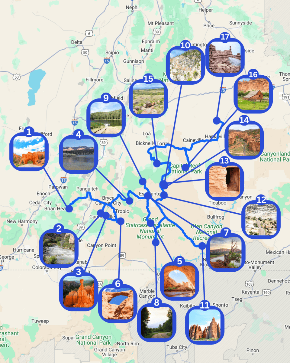
1. Dixie National Forest / Red Canyon
Just a short drive from Bryce Canyon, you'll find the enchanting Red Canyon in the Dixie National Forest. This region is rich in red rock formations and inviting hiking trails, attracting adventurers and nature lovers alike.
Before heading to Highway 12, visiting the Red Canyon Visitor Center is highly recommended. Here, you can find various gifts, souvenirs, maps, books, and detailed trail information to help plan your visit.
The area's breathtaking panoramas have captured the hearts of photographers from around the globe.
Trails like the Birdseye Trail offer moderate hikes over 0.8 miles with captivating views, and the more challenging 3-mile Losee Canyon Trail allows adventurers to immerse themselves in the stunning red rock landscapes.
Additionally, you can enjoy various recreational activities such as bicycling, horseback riding, and off-highway vehicle riding, ensuring visitors of all interests can find something enjoyable!
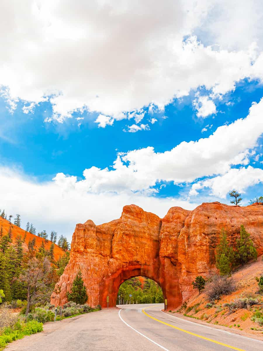
2. Sevier River and Tropic Reservoir
Next is the serene Sevier River, which gracefully flows into Tropic Reservoir. This idyllic setting is perfect for fishing enthusiasts and wildlife observers and offers many activities, such as boating, canoeing, and hiking.
You can access the river via Highway 89, and while it's not right on Byway 12, it's close enough that a short drive will get you to its flowing waters and scenic beauty.
Consider hiking or biking along the Big Rock Candy Mountain trail for a deeper connection with nature. This route takes you through quaint farming communities nestled along the riverbanks, offering a glimpse into rural life amidst breathtaking scenery.
For those looking to explore the area further, hiking trails begin at the Tropic Reservoir, wind through the Dixie National Forest, and offer views of this stunning landscape.
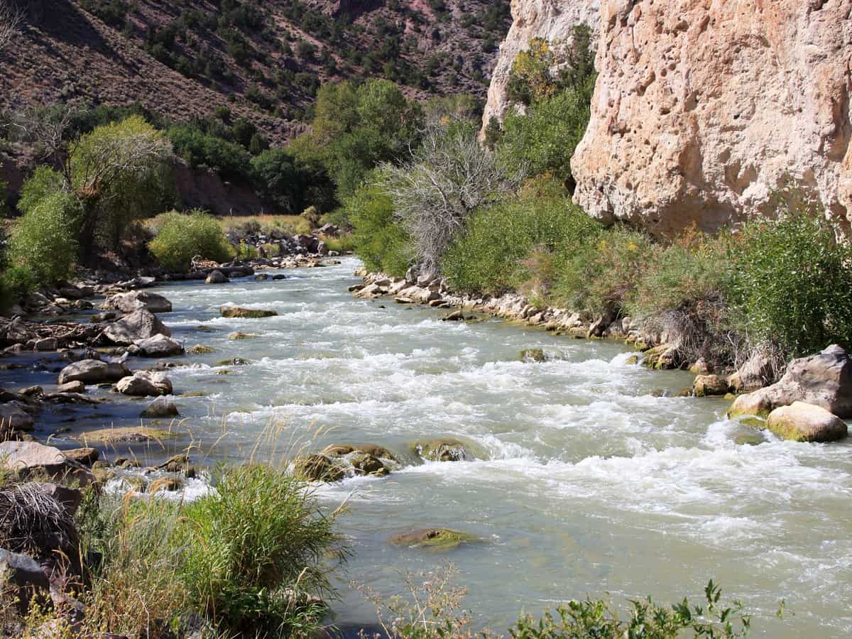
3. Bryce Canyon National Park
Famous for its unique hoodoo rock formations, Bryce Canyon National Park is a marvel of the natural world.
You can enjoy panoramic views from the rim or hike into the canyon on trails for an up-close experience with the park's distinctive geology.
To reach Bryce Canyon effortlessly, travel east on UT-12 and continue onto UT-63, which leads you directly into the park. Once at the park, the visitor center is just one mile inside the park boundary, welcoming you to this natural sanctuary.
Bryce not only showcases natural beauty but also offers various activities and experiences. We recommend exploring the Fairyland Loop, a lesser-known trail that spans approximately 8 miles and provides serene views away from the crowds.
Historical attractions, like the nearby Anasazi State Park Museum (which we'll also cover later), enrich visitors' understanding of the region's ancient human history.
There are plenty of unique experiences to enjoy, from stargazing events under some of the clearest skies in the U.S. to guided full moon hikes and horseback riding tours through the majestic canyon.
Of course, the park is also home to a diverse ecosystem that's truly a sight to behold, featuring mule deer, mountain lions, and a vibrant display of wildflowers in the spring and summer.
4. Pine Lake and Powell Point
Pine Lake and Powell Point offer distinct experiences in Utah's diverse landscape, perfect for adventurers seeking solitude and natural beauty.
Pine Lake is about 37 miles from Panguitch and 10 miles from Tropic, making it a bit of a drive, but the scenery and peaceful lake setting are worth it.
You can get there by car by heading south from Panguitch on Hwy 89, then turning on Hwy 12, and finally onto Pine Lake Road.
Forests surround the lake, an excellent place for fishing, with brown, cutthroat, and rainbow trout in the water. There's also a campground by the lake with spots for tents and RVs, available from May to October.
Powell Point is more of an adventure, requiring a high-clearance 4x4 vehicle due to the rugged terrain. It's known for its stunning views from one of the highest points in the area.
If you're up for the challenge, the views are some of the best, giving you a broad look over the Utah landscape. The area around Powell Point is also great for hiking, with trails that offer a closer look at the local flora and fauna.
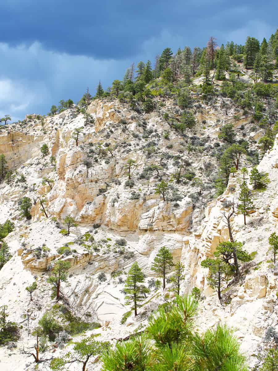
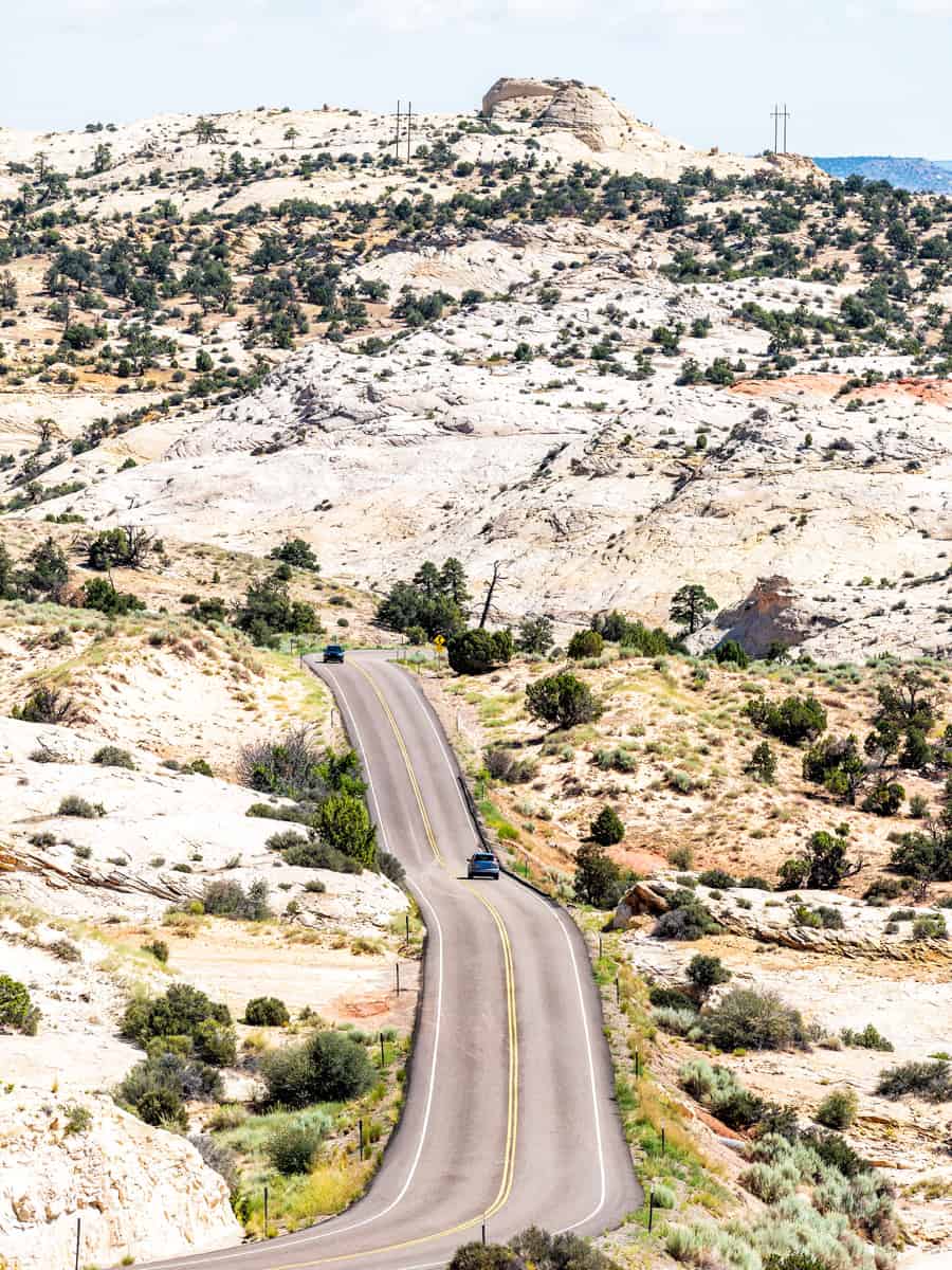
5. Grand Staircase-Escalante National Monument
This vast national monument spans many miles of Utah's wilderness, featuring geological formations, archaeological sites, and a variety of trails.
Scenic Byway 12 cuts through this monument, offering accessible vistas of its expansive landscapes.
The monument is split into different areas, each with its own unique things to see. For example, the Escalante Canyons are great for hiking and seeing natural arches, while the Grand Staircase area has a lot of slot canyons.
There's also the Kaiparowits Plateau, known for its fossils that tell us about life millions of years ago.
There are many hiking trails, from easy walks to more challenging hikes. Some trails will take you to see waterfalls, and others through narrow canyons.
Trails like Willis Creek Narrows and Lower Calf Creek Falls lead visitors through breathtaking landscapes, offering up-close encounters with the monument's natural splendor.
Besides the beautiful landscapes, there are also historical sites where you can learn about the Anasazi and Fremont cultures, which once thrived in the area long ago.
6. Kodachrome Basin State Park
Kodachrome Basin State Park is 9 miles southeast of Cannonville through Cottonwood Canyon Road.
The area's geological wonders are believed to have been shaped by ancient geothermal springs and other natural processes, creating a landscape filled with spires, columns, and monolithic stone spires known as sedimentary pipes.
These features, number 67 throughout the park, are a spectacle, especially at sunset when the rocks glow in the evening light!
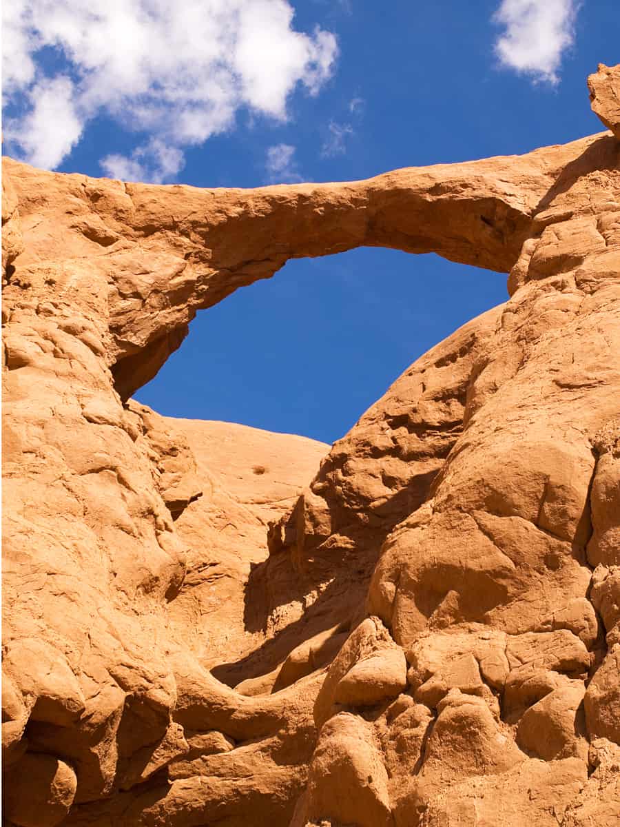
The area is also home to the renowned Shakespeare Arch and Sentinel Trail.
Although Shakespeare Arch collapsed in 2019, the trail remains popular for those seeking a slightly more strenuous adventure with rewarding vistas over the Grand Staircase-Escalante National Monument.
Besides hiking, you can also ride horses or bikes on some trails, and at night, you can see lots of stars because it's one of the best places for stargazing. It's open all year so you can visit anytime, but spring and fall have the best weather for being outside.
7. Escalante Petrified Forest State Park
Just an hour's drive from Kodachrome Basin, Escalante Petrified Forest State Park invites you on a journey through time with its trails winding through ancient petrified forests.
This park provides a fascinating glimpse into prehistoric life, captivating visitors with its remarkable collection of Triassic-era fossils that are a highlight for many.
One of the main trails is the Petrified Forest Trail, a one-mile loop that takes you through old lava flows and forests of juniper trees.
If you're up for more adventure, you can try the Sleeping Rainbow Trail. It's a bit tougher and goes up and down hills, but it takes you to spots with petrified wood.
Besides the fascinating petrified wood, the park includes a reservoir for swimming and fishing, making it a popular spot for leisure.
You can learn more about the petrified wood at the visitor center and see some fossils of dinosaur bones over 150 million years old. It's an excellent place to start your visit.
This park is open all year, but the best time to visit is from late March to September when the weather is nicer. If you go in summer, try to hike early in the morning or late in the day to avoid the heat.
8. Smoky Mountain Road
Linking Escalante to Big Water by Lake Powell, Smoky Mountain Road goes through tough landscapes, and you can only drive through it easily when it's dry.
The road is about 78 miles long. It takes you through amazing places, offering unparalleled views of Lake Powell, the Navajo Mountains, and the Kaiparowits Plateau as it winds through the Grand Staircase Escalante National Monument and Glen Canyon National Recreation Area.
Starting in Big Water, the road quickly turns from paved to a well-graded dirt surface, passing through moon-like landscapes of smooth, dark gray rocks.
The road has a lot of turns and goes up and down, so you need a strong car that can handle rough roads to go here. The road climbs 1,200 feet up Smoky Mountain via thrilling switchbacks, revealing breathtaking vistas at every turn.
High-clearance, 4WD vehicles are recommended, along with necessary supplies like a full tank of gas, spare tires, and plenty of water, as services are non-existent along the way.
Before embarking on this adventure, checking current road conditions is crucial, especially since the road can become impassable during wet weather.
9. Posey Lake
This picturesque lake, located northwest of Escalante, is a favored local spot for fishing and relaxation. Surrounded by scenic views, it's a peaceful retreat from the more traveled paths.
Sitting high on the Colorado Plateau at 8,800 feet, it's a great place for people who love fishing and enjoying quiet moments in nature.
The lake is surrounded by tall pine trees and aspens, making it a pretty place to spend time away from more traveled paths.
To reach Posey Lake from Highway 12 in Escalante, you'll turn north at 300 East at the Posey Lake/Hell's Backbone sign, traveling 14 miles to the junction of Forest Roads 153 and 154, then keeping left for another 2 miles to the campground.
The travel involves about 14 miles of gravel road with some steep sections, so vehicles over 30 feet in length are not recommended.
Once there, you can canoe, kayak, and fish since the lake is home to fish like rainbow and brook trout.
There are also a couple of hiking trails starting right at the campground. One is the Posey Overlook Trail, which is about 1.4 miles long and gives you a beautiful view of the lake and the area around it.
It's peaceful because motorized boats aren't allowed, which keeps it quiet. And since it's a bit out of the way, it's not as crowded as other places, making it a nice spot to enjoy the outdoors without many people around.
10. Hell’s Backbone
From Posey Lake, Hell's Backbone presents a challenging yet thrilling drive through some of Utah's most untouched wilderness.
This 38-mile loop, accessible just south of Boulder and reconnecting with Highway 12 near Escalante, offers dramatic and diverse landscapes.
But be aware! The road is good for regular cars only when it's dry. It goes through tough land, connecting the big Boulder Mountain with the deep valleys carved by the Escalante River.
Along the way, there are opportunities for unique experiences such as hiking hidden trails like The Box, a mysterious canyon offering an 8.5-mile exploration through multicolored sandstone carved by water.
It's a good place for a quiet walk to see the colorful rock walls and the stream that cut through the canyon. The road has a lot of history. It was built in the 1930s to connect two towns, Boulder and Escalante.
There are places to camp near the road, like Blue Spruce Campground and Posey Lake Campground, where you can stay and enjoy the quiet and cool air.
The area around Hell's Backbone is home to many different plants and animals, making it an excellent spot for nature lovers!
11. Hole-in-the-Rock
This historic path stretches into the Glen Canyon National Recreation Area and was initially paved by Mormon settlers in 1879 to build a route for southward migration.
It takes you through some breathtaking views over Lake Powell, which forks off from Byway 12 and stretches about 55.5 miles to the Hole-in-the-Rock site on Lake Powell's shore.
Among the highlights along the road is Devil’s Garden, located just under 12.5 miles from its junction with SR-12, featuring unique rock formations and accessible natural wonders.
The road is a piece of history, showing the hard work of the Mormon settlers who made their way through wild lands to make this path.
At the end of the road is the Hole-in-the-Rock, which used to be a way to get to the Colorado River below. Now, it offers amazing views of Lake Powell, wrapping up your journey with a look back in time and a great view.
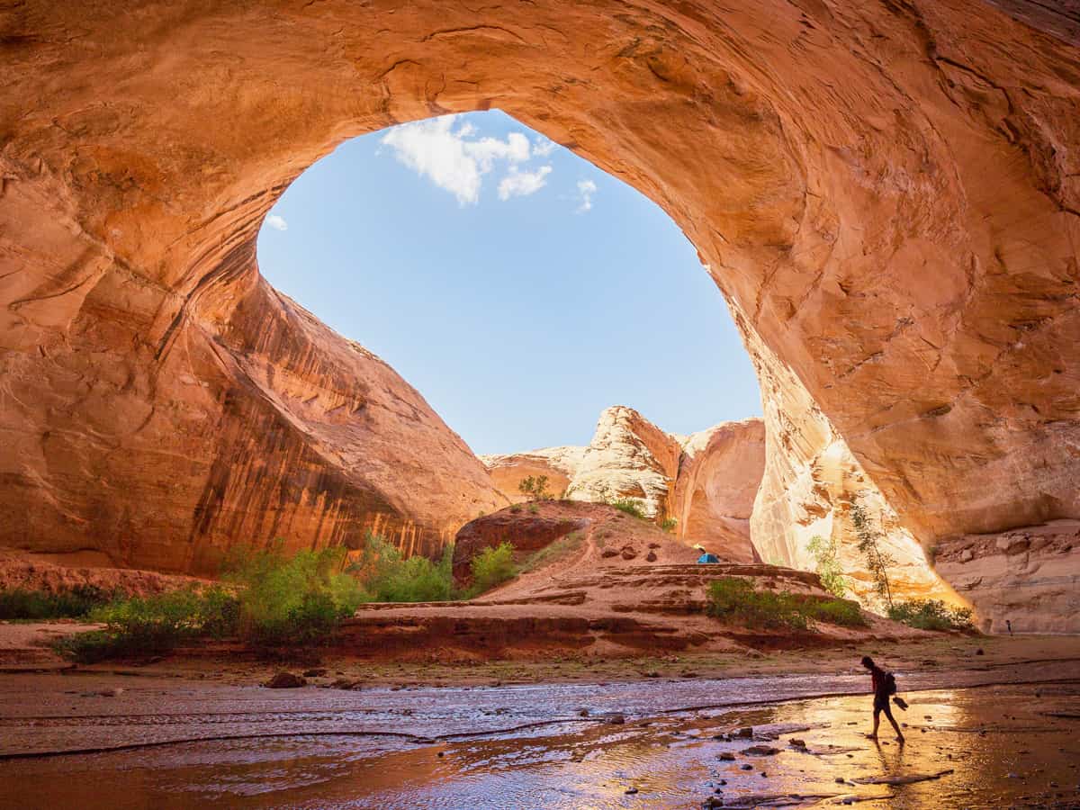
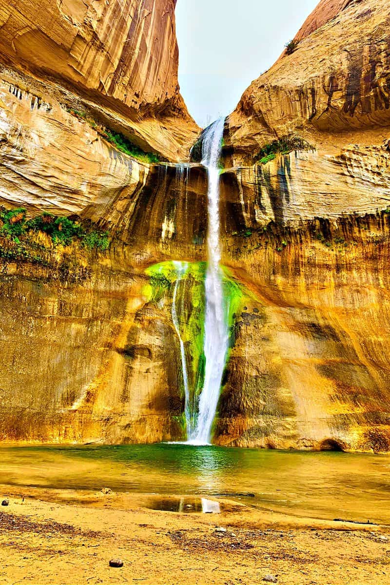
12. Calf Creek Recreation Area
Located directly off Utah Scenic Byway 12, about five miles east of Escalante, this oasis in the desert is renowned for its stunning waterfalls. One is the Lower Calf Creek Falls—a 126-foot waterfall cascading into a refreshing pool.
The area offers more than just a chance to cool off; it's a journey through lush vegetation and towering sandstone cliffs that encapsulate the beauty of southern Utah.
The trek to Lower Calf Creek Falls is moderately easy, though the sandy trails may be tiring for your feet. En route, you'll encounter ancient granaries, rock art, and beaver dams.
Lower Calf Creek Falls
For a shorter journey, Upper Calf Creek Falls offers a 2-mile round trip to an 88-foot cascading waterfall. This tranquil spot often provides a more secluded experience.
In the area surrounding the falls, the diverse ecosystem is perfect for wildlife and botanical observation. Keep an eye out for beavers, various bird species, and a stunning array of plant life, particularly vibrant in the spring and summer months.
13. Anasazi State Park Museum
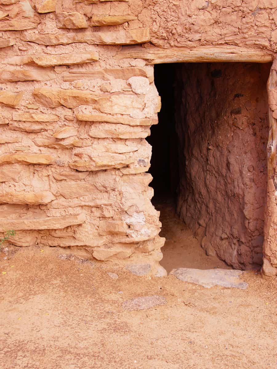
Situated in the scenic town of Boulder, the Anasazi State Park Museum is a captivating destination that offers a window into the lives of the Ancestral Puebloans, also known as the Anasazi around 1050 to 1200 A.D.
Within the museum, you can discover more than 1,000 artifacts, such as pottery unearthed from the area, offering insights into these ancient inhabitants' daily lives and customs.
Beyond the indoor exhibits, the museum offers a self-guided tour along a short trail to the Coombs Site Ruins.
Here, you can wander through a life-size, six-room replica of an Anasazi pueblo, offering insights into this ancient community's daily lives and architectural ingenuity.
The trail has interpretive signs highlighting significant archaeological finds and the area's natural history.
14. Burr Trail
This trail takes you through a scenic drive through Capitol Reef National Park and into the northern reaches of Lake Powell. The road from Boulder is smooth and paved at first, making it easy for any car to travel and enjoy the stunning views.
It was initially a cattle trail by stockman John Atlantic Burr and now serves as a captivating journey through Utah's rugged backcountry, extending from Boulder to Bullfrog Marina.
As you drive, you'll be greeted with the vast expanse of slick rock mountains and sandstone dunes, descending into the breathtaking Long Canyon.
You'll also get to see the towering red cliffs of the Waterpocket Fold, offering unrivaled vistas and photo opportunities, especially from the top of the Burr Trail switchbacks.
All that said, the Burr Trail is not just about the drive; numerous hiking trails near the area, like the Lower Muley Twist Canyon and Surprise Canyon provide adventurous souls the chance to explore on foot.
As a bonus, you don’t need to pay anything to drive on this road. If it rains, the road can be tricky because of the mud. Also, bring water and snacks since there aren’t many places to stop and shop along the way.
15. Boulder Mountain
Also known as the Aquarius Plateau, Boulder Mountain is renowned for its numerous lakes and stunning panoramic views.
The area is a haven for anglers, hikers, and those looking to explore the less-trodden paths of Utah's high country. This expansive area sprawls over 50,000 acres and features over 80 lakes where you can go fishing.
You can also go hiking with trails ranging from easy to moderate, allowing for exploration of high-alpine lakes, forests, and meadowlands.
The highest peak, Bluebell Knoll, offers breathtaking views of Capitol Reef National Park and the Grand Staircase–Escalante National Monument.
16. Capitol Reef National Park
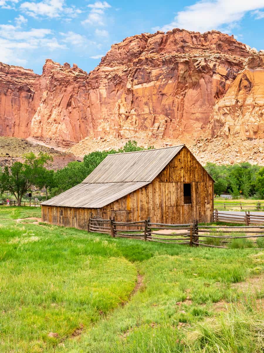
This unique national park is distinguished by its colorful canyons, towering cliffs, and hidden arches, set against the backdrop of the Waterpocket Fold—a 100-mile-long wrinkle in the Earth's crust.
Here, you're treated to a visual feast that includes the rugged western escarpment, the serene Grand Wash, and the massive, sheer cliffs of Wingate Sandstone.
Alongside these majestic views, it's also packed with historical attractions, including the Fruita Schoolhouse and the Gifford Homestead, which offers a glimpse into the lives of early Mormon settlers.
And while you're marveling, you might as well stay to stargaze. The park's remote location away from light pollution means the night skies are incredibly clear, an ideal spot to watch the Milky Way as it stretches across the sky.
17. Goblin Valley
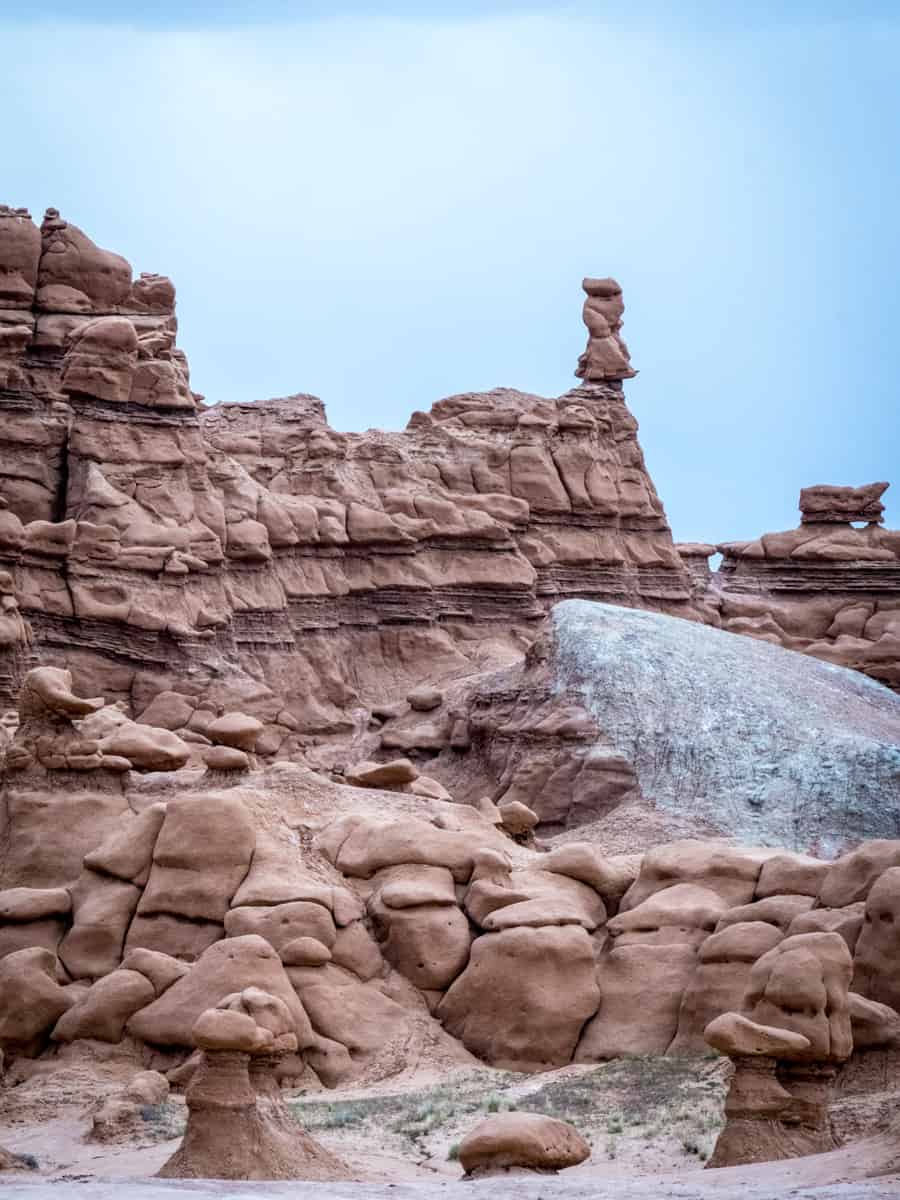
Located near Hanksville, approximately 216 miles southeast of Salt Lake City, Goblin Valley can be reached by a scenic detour from I-70, taking State Highway 24 south to the signed park turnoff.
This spot is filled with whimsical rock formations known as hoodoos, which resemble goblins—a must for families to explore, offering countless nooks and crannies that spark the imagination.
The landscape here is so otherworldly that it served as a filming location for the movie "Galaxy Quest."
For fun with friends, you can go hiking the trails, such as the 1.5-mile Carmel Canyon Loop Trail and 1.8-mile Entrada Canyon, and discover the park's unique geology and expansive vistas.
If you're up for more, Little Wild Horse Canyon is an 8-mile hike through beautiful slot canyons.
You're also in a prime spot for stargazing, thanks to the park's status as a certified International Dark Sky Park, and if you're into mountain biking, the seven miles of the Wild Horse Trail System are perfect for you.
For those seeking more adventure with more adrenaline, consider canyoneering in Goblin’s Lair. Remember, this requires a backcountry permit and the right gear to tackle the challenge safely.
Planning Your Scenic Byway 12 Road Trip
As we've explored, each of the 17 points along this route presents a unique story, blending natural wonders with historical depth and various activities.
Whether you're seeking the tranquility of Pine Lake, the prehistoric echoes of Anasazi State Park Museum, or the adventurous roads of Hell’s Backbone and Burr Trail, Byway 12 caters to every traveler.
Here are some simple tips to make your trip along Utah's Scenic Byway 12 even better:
- Plan Ahead: Research the points of interest along Byway 12 to determine which stops you'd like to prioritize. Consider the season, as some areas may be less accessible during winter or after heavy rains.
- Start Early: Many sites along Byway 12 become quite busy, especially during peak tourist seasons. Starting your day early can help you avoid the crowds.
- Stay Hydrated and Prepared: The climate in this region can be harsh, with high temperatures in the summer and cold conditions in the winter. Carry plenty of water, sunscreen, and appropriate clothing for the season.
- Respect the Environment: As you explore the natural beauty of Byway 12, ensure you leave no trace behind. Stay on designated trails, take all your trash with you, and watch wildlife from a safe distance.
- Take Your Time: There’s much to see, so don’t hurry. Give yourself time to enjoy the views, take pictures, and discover places you didn’t expect to find.
- Stay Safe: Some places can be remote and wild. Tell someone about your travel plans, bring a first aid kit, and ensure you have what you need in an emergency.
- Support Local: Whether stopping at a local diner, shopping at a small boutique, or staying at a locally-owned lodge, supporting the local economy enhances your trip and contributes to the community.
- Capture Memories, Leave No Trace: While photography is a beautiful way to capture the beauty of Byway 12, ensure that your quest for the perfect photo does not damage the environment or disrespect cultural sites.
By following these tips, your journey along Utah's Scenic Byway 12 can be both enjoyable and respectful of the natural and cultural treasures you'll encounter.
Grateful for compiling this information. Thank you. Any recommendations on when (what months) might make the most of an identical trip using this path?
Hi Manish, spring and autumn work best for Utah. See more here: The Ultimate Utah National Parks Road Trip
Looking for things to see and do as we leave Yuma Az back into Canada. Good info. Thanks.