Getting around Florida by public transportation isn't quite like the big-city transit systems you might find in New York, Chicago, or San Francisco.
Here, your journey might include a mix of buses, trains, and trolleys, each weaving through bustling urban centers and tranquil coastal scenes.
Don't get us wrong, Florida's network does cover a lot, but it lacks the frequency and extent many travelers expect. For example, buses in Miami might run every 15-30 minutes, but you could wait over an hour in more secluded areas.
That's exactly why knowing the schedules and connections can save you time and spare you the hassle. Here’s a complete guide to give you a clearer picture of what to expect from public transport in the beautiful Sunshine State!
The Reality of Florida's Transportation Network
Florida offers various public transport options, including buses, trains (such as Brightline and SunRail), and city trolleys, which are great for getting around urban areas, but these options come with limitations.
Coverage can be spotty, particularly outside urban centers, and the frequency of services often leaves much to be desired.
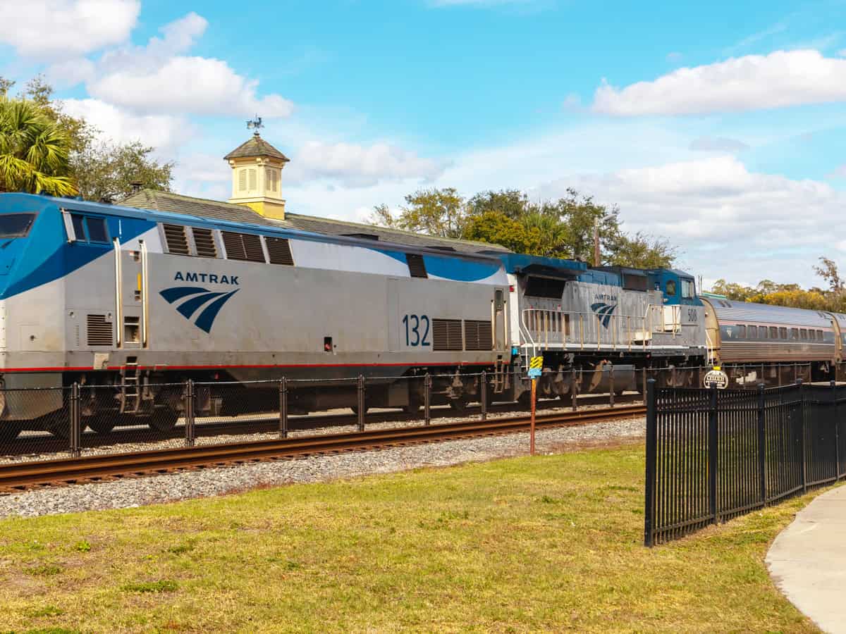
Delays are also a common problem, especially with trains like Amtrak, which share tracks with freight lines. Making connections between different modes of transport can be tricky and sometimes confusing.
Normally, people, including locals, would recommend renting a car or bringing your own when traveling around Florida — and that’s our recommendation, too.
But if driving isn't an option for you, don’t worry — we’ll provide an extensive overview of what to expect from public transportation in Florida, particularly in the most popular cities tourists often visit. This way, you can plan your travels with a clearer picture of the situation.
Main Modes of Transportation
Florida has many ways to help you get around, from big cities to beaches and all your favorite spots.
For traveling far, you can use Amtrak trains across the state, Megabus for cheaper bus rides, and the Brightline train for fast trips between major cities.
If you're moving around locally, you might use city buses, the Metrorail in Miami, or the LYNX bus system in Orlando. These options make it easier to explore Florida’s cities and beautiful beaches.
| Mode | Area Served | Useful For |
|---|---|---|
| City Bus | Miami (Miami-Dade Transit), Orlando (LYNX), Tampa (HART), Jacksonville (JTA), Tallahassee (StarMetro), Fort Lauderdale (Broward County Transit), West Palm Beach (Palm Tran) | Economical travel across urban and suburban areas |
| Trolley | Orlando - International Drive (I-RIDE Trolleys), Miami Beach (South Beach Local), Tampa (TECO Line Streetcar), Key West (Old Town Trolley), Fort Lauderdale (Sun Trolley), St. Petersburg (Looper Trolley), Clearwater (Jolley Trolley) | Convenient for tourists visiting popular areas and attractions |
| Shuttle Services | Orlando - Theme parks, airport; Tampa - Airport, cruise ports; Miami - Airport, cruise ports; Fort Lauderdale - Airport, cruise ports; Jacksonville; West Palm Beach; Sarasota - primarily airports | Ideal for direct transfers to airports and theme parks |
| Rideshare (Uber, Lyft) | Statewide | Personalized and flexible travel options |
| Bike Share | Miami (Citi Bike), Orlando (Juice bike share), Tampa (Coast Bike Share), St. Petersburg (Coast Bike Share), Fort Lauderdale (Broward B-cycle), Tallahassee (Gotcha Bike Share) | Suitable for short trips within local areas |
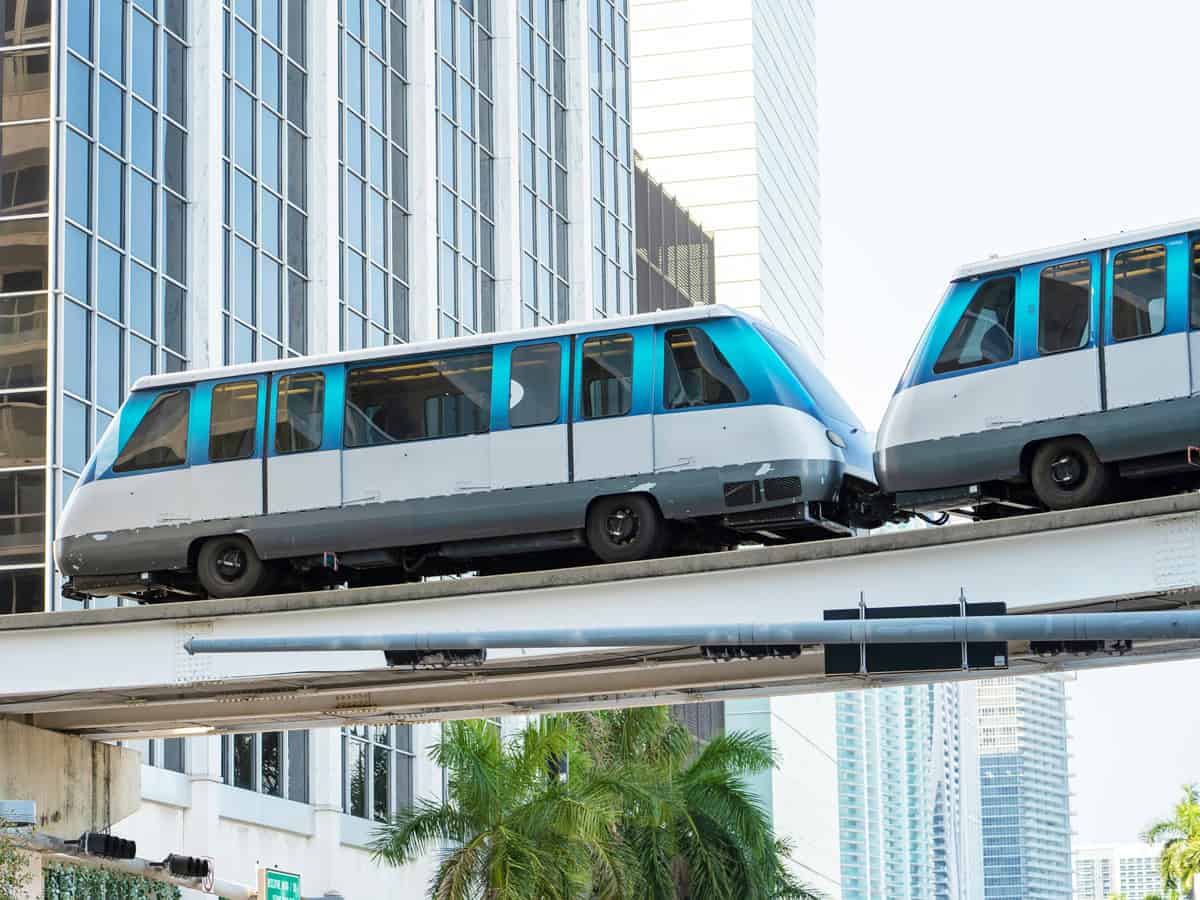
| Metrorail System | Miami-Dade County (Miami-Dade Transit) | Efficient navigation within Miami |
| Metromover | Downtown Miami, Brickell (Miami-Dade Transit) | Free urban transit within downtown areas |
| Water Taxi | Fort Lauderdale - Intracoastal Waterway (Fort Lauderdale Water Taxi), Miami - Miami River, Biscayne Bay (Miami Water Taxi), Tampa - Downtown to St. Petersburg (Tampa Water Taxi) | Scenic routes along coastal and intra-coastal waterways |
| Amtrak | Statewide - key stops include Miami, Orlando, Tampa, Jacksonville | Long-distance rail travel |
| Brightline | Efficient Urban Navigation within Miami | High-speed rail connections between major cities |
| Megabus | Major cities including Miami, Orlando, Tampa, Jacksonville | Cost-effective long-distance bus travel |
Miami Public Transportation
Miami offers a range of public transportation options that make it relatively easy to get around the city and the surrounding areas.
You can hop on the Metrorail, which connects major points like Miami International Airport and Downtown Miami along a 25-mile track. It's fast, efficient, and perfect for avoiding city traffic.
For shorter trips around downtown, the Metromover is ideal. This free service runs three loops covering downtown, including stops near Bayside Marketplace and American Airlines Arena. It operates every day and costs nothing to ride.
If you’re looking to explore wider Miami, the Metrobus goes to all the key areas, including Miami Beach and Coral Gables, taking you right to the doorstep of malls, parks, and beaches.
Want a unique local experience? Try the trolley. It's free, fun, and a great way to navigate neighborhood hotspots like Little Havana and Wynwood. The service can vary, with some routes running as often as every 15 minutes or up to every 45 during off-peak times.
All these services are accessible with an EASY Card or EASY Ticket, which can be topped up online. Nowadays, you can even tap to pay quickly with mobile payments.
| Transportation | Primary Areas Served | Route Map | Fee |
|---|---|---|---|
| Metrorail | Miami International Airport, Downtown Miami, Dadeland South | Metrorail Map | Use EASY Card |
| Metromover | Downtown Miami, Bayside Marketplace, AmericanAirlines Arena | Metromover Map | Free |
| Metrobus | Miami Beach, Coral Gables, Aventura, West Miami-Dade | Metrobus Maps | Use EASY Card |
| Miami Trolley | Little Havana, Wynwood, Coconut Grove, Miami Design District | Trolley Maps | Free |
| Tri-Rail | Miami, Fort Lauderdale, West Palm Beach | Tri-Rail Map | Use EASY Card (in Miami-Dade) |
Tampa Public Transportation
Getting around Tampa is hassle-free, thanks to an array of public transport options tailored for you as a traveler.
The Hillsborough Area Regional Transit (HART) offers buses that can take you anywhere within the city. You can also hop on the TECO Line Streetcar for a free ride to iconic locations like Ybor City.
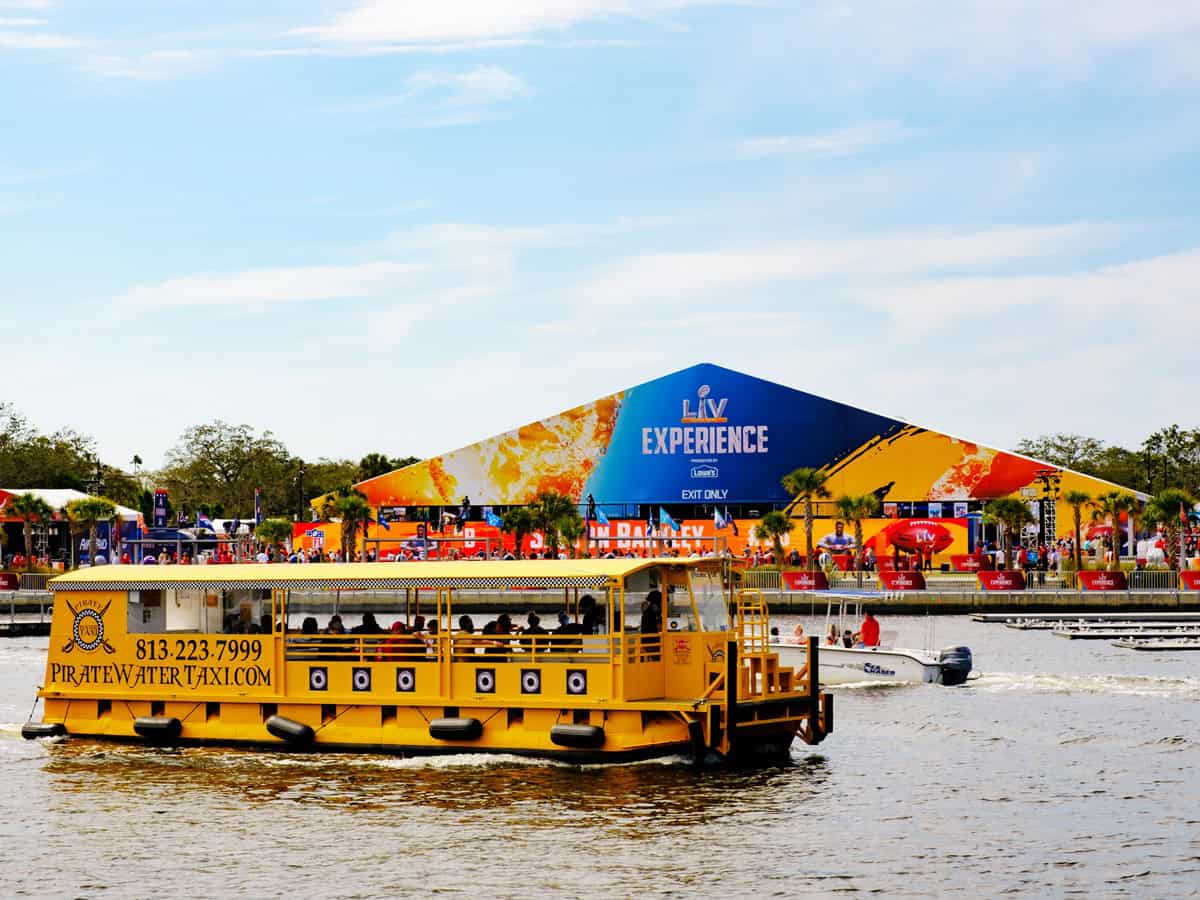
For a unique journey, consider the Pirate Water Taxi. It’s a hop-on hop-off service that stops at all the main attractions along the waterfront, perfect for tourists or a leisurely day out.
If you prefer biking, Coast Bike Share features hundreds of bikes across many stations, which are easily rentable through a mobile app. It’s a fun, healthy, and eco-friendly way to tour downtown and neighborhoods.
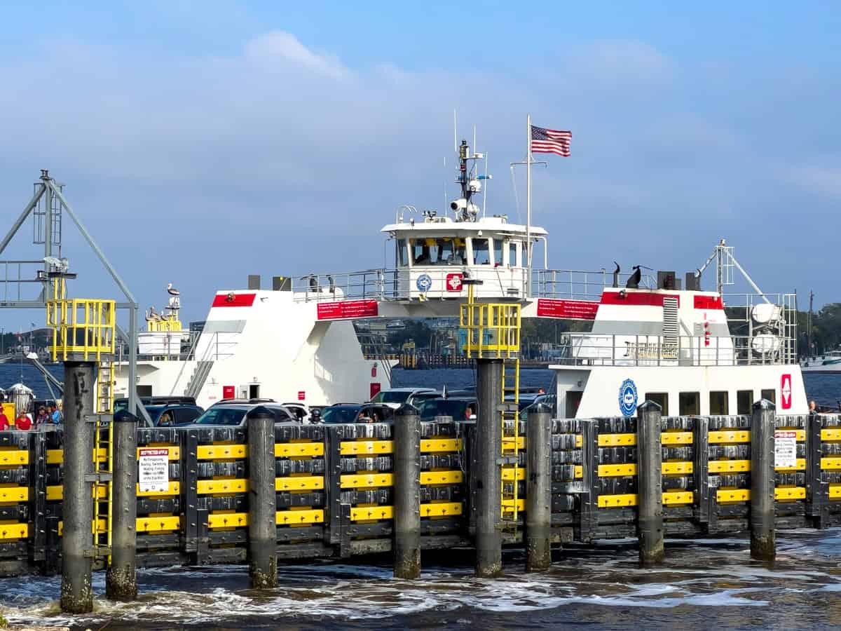
Crossing the bay? The Cross-Bay Ferry is a relaxing way to travel between Tampa and St. Petersburg and offers a picturesque alternative to driving. It operates seasonally and is popular for avoiding traffic while soaking up the sun and sea.
TBARTA, the regional authority, also offers carpooling and vanpooling services for shared commuting options across multiple counties, including Hillsborough.
Most transit services in Tampa use Flamingo Fares, a single payment system that makes it easy to pay for different types of public transport. You can learn more about how it works here.
| Transportation | Primary Areas Served | Route & Maps | Fee |
|---|---|---|---|
| HART Buses | Tampa and Hillsborough County | HART Route Maps | Use Flamingo Fares |
| TECO Line Streetcar | Downtown Tampa, Channelside, Ybor City | Streetcar Map | Free |
| Pirate Water Taxi | Stops along the Hillsborough River including Downtown and more | Water Taxi Map | Varies by trip |
| Coast Bike Share | Downtown Tampa and surrounding neighborhoods | Bike Share Map | Varies by duration |
| Cross-Bay Ferry | Tampa and St. Petersburg | Ferry Route | Varies by age |
Orlando Public Transportation
In Orlando, LYNX buses cover a wide area with routes that stretch across Orange, Osceola, and Seminole counties, connecting you to key spots like downtown, various theme parks, and Orlando International Airport.
Every bus features bike racks, making it easy to combine cycling with your bus ride.
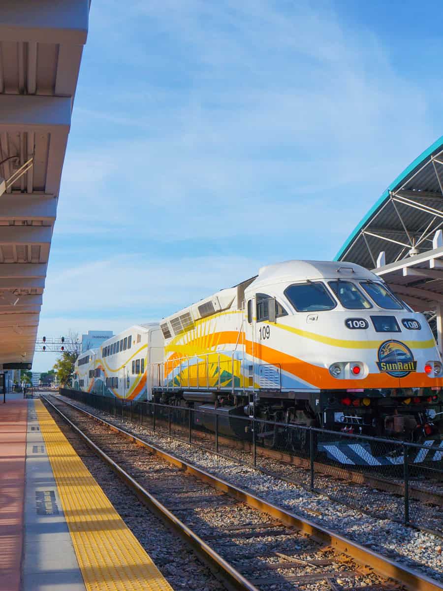
The SunRail train links Volusia and Osceola counties through downtown Orlando. This commuter rail makes stops at central locations, including Winter Park and Kissimmee, which are ideal for avoiding traffic and skipping the parking hassle, especially during rush hour.
For quick trips around downtown, the LYMMO bus service is completely free and operates on dedicated lanes. It features three main lines — Orange, Lime, and Grapefruit — each serving different parts of the city center, making it perfect for easy downtown explorations.
| Transportation | Primary Areas Served | Route & Maps | Fee |
|---|---|---|---|
| LYNX Bus | Orange, Seminole & Osceola counties, including routes to theme parks and major attractions | LYNX Routes & Schedules | Fee payable via cash or PawPass app |
| SunRail | Volusia County to Osceola County through Downtown Orlando | SunRail Route Map | Fee payable via SunRail passes or tickets |
| LYMMO | Downtown Orlando (North Quarter, Central Business District, Thornton Park, Creative Village, Amway Center, County Courthouse) | LYMMO Route Map | Free |
Jacksonville Public Transportation
One of the most convenient ways to explore this city is through the services provided by the Jacksonville Transportation Authority or JTA.
The JTA runs bus services across more than 30 routes, helping you reach every nook and cranny of the city. It's also possible to ride above traffic with the unique JTA-operated Skyway. This 2.5-mile monorail connects the Northbank and Southbank areas of downtown.
It’s ideal for skipping the rush-hour buzz and soaking in aerial views of the city. Plus, Park-n-Ride facilities are convenient for those driving into the city.
Additionally, the JTA offers a variety of specialized services:
- Paratransit Services: Known as Connexion, these services provide door-to-door transportation for residents with disabilities who cannot use traditional bus services.
- St. Johns River Ferry: This ferry service links the northern and southern ends of Florida State Road A1A, providing a scenic route across the St. Johns River.
- Express-Select Services: Regional bus services that connect downtown Jacksonville to surrounding counties, offering executive-style comfort and amenities.
| Transportation | Primary Areas Served | Route & Maps | Fee payable by cash or via the MyJTA app |
|---|---|---|---|
| JTA Bus Services | Citywide across Jacksonville | JTA Bus Routes | Fee payable by cash or via MyJTA app |
| Skyway | Downtown Jacksonville (Northbank to Southbank) | Skyway Route & Map | Free |
| St. Johns River Ferry | Mayport Village to Ft. George Island | Ferry Schedule | Varies for pedestrians and vehicles |
| Express Select Services | Regional service to surrounding counties | Express-Select Routes and Stops | Varies; executive-style amenities |
| Connexion Paratransit | Door-to-door within Duval County for eligible residents | Connexion Services | The fee varies; eligibility is required |
St. Petersburg Public Transportation
Public transportation in St. Petersburg, Florida, is primarily managed by the Pinellas Suncoast Transit Authority (PSTA), which offers various services, including standard bus routes, express routes, and specialized trolleys.
Here, you can hop on the SunRunner, St. Petersburg's first Bus Rapid Transit service for frequent service. It whisks you from the beaches to the downtown 'Burg quickly, thanks to dedicated lanes that dodge traffic.
With buses running every 15 minutes during peak hours, your wait times are minimal.
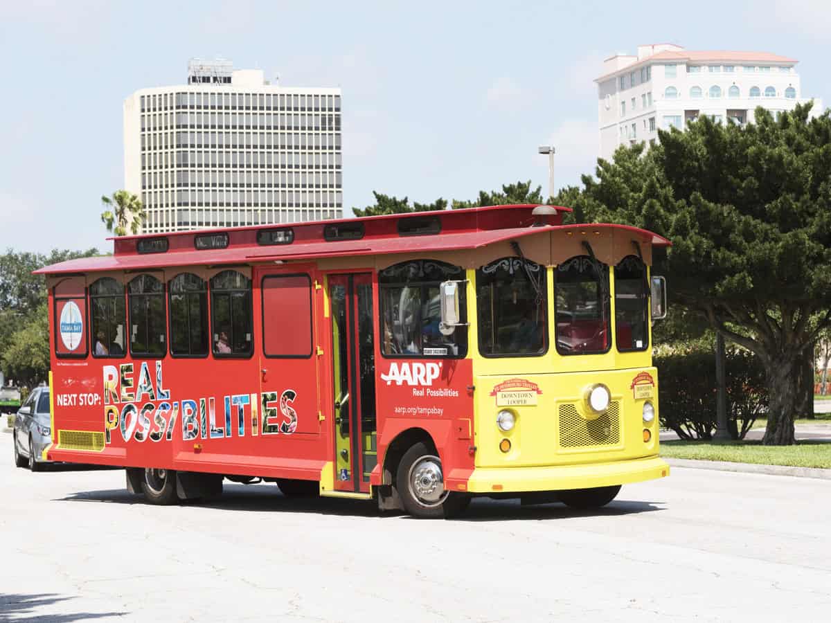
For an authentic local experience, the Downtown Looper trolley service circles downtown, offering easy access to major attractions.
Another great option is the Suncoast Beach Trolley. This trolley runs along the Gulf Coast from St. Pete Beach to Clearwater Beach, passing through various communities.
| Transportation | Primary Areas Served | Route & Maps | Fee Information |
|---|---|---|---|
| SunRunner | Beaches to Downtown St. Petersburg | SunRunner Route Map | Pay via Flamingo Fares |
| Downtown Looper | Downtown St. Petersburg | Downtown Looper Route | Free |
| Suncoast Beach Trolley | St. Pete Beach to Clearwater Beach via coastal communities | Suncoast Beach Trolley Route | Pay via Flamingo Fares |
Tallahassee Public Transportation
You can get around this picturesque capital city with StarMetro, the city's public transit service, which operates a network of buses ready to take you through downtown, to various campuses, and several neighborhoods.
You can check out all the routes and schedules online to make sure you catch your ride and don’t miss out on visiting places like the historic Capitol building or the beautiful canopy roads.
StarMetro also offers a Dial-A-Ride service, which is super handy if you need door-to-door transportation. Just remember to book these rides in advance to avoid any wait.
Plus, the Tallahassee Downtown Trolley is a fun, free way to zip around the city center. It stops at all the major spots downtown, making it easy to hop on and off as you explore the area.
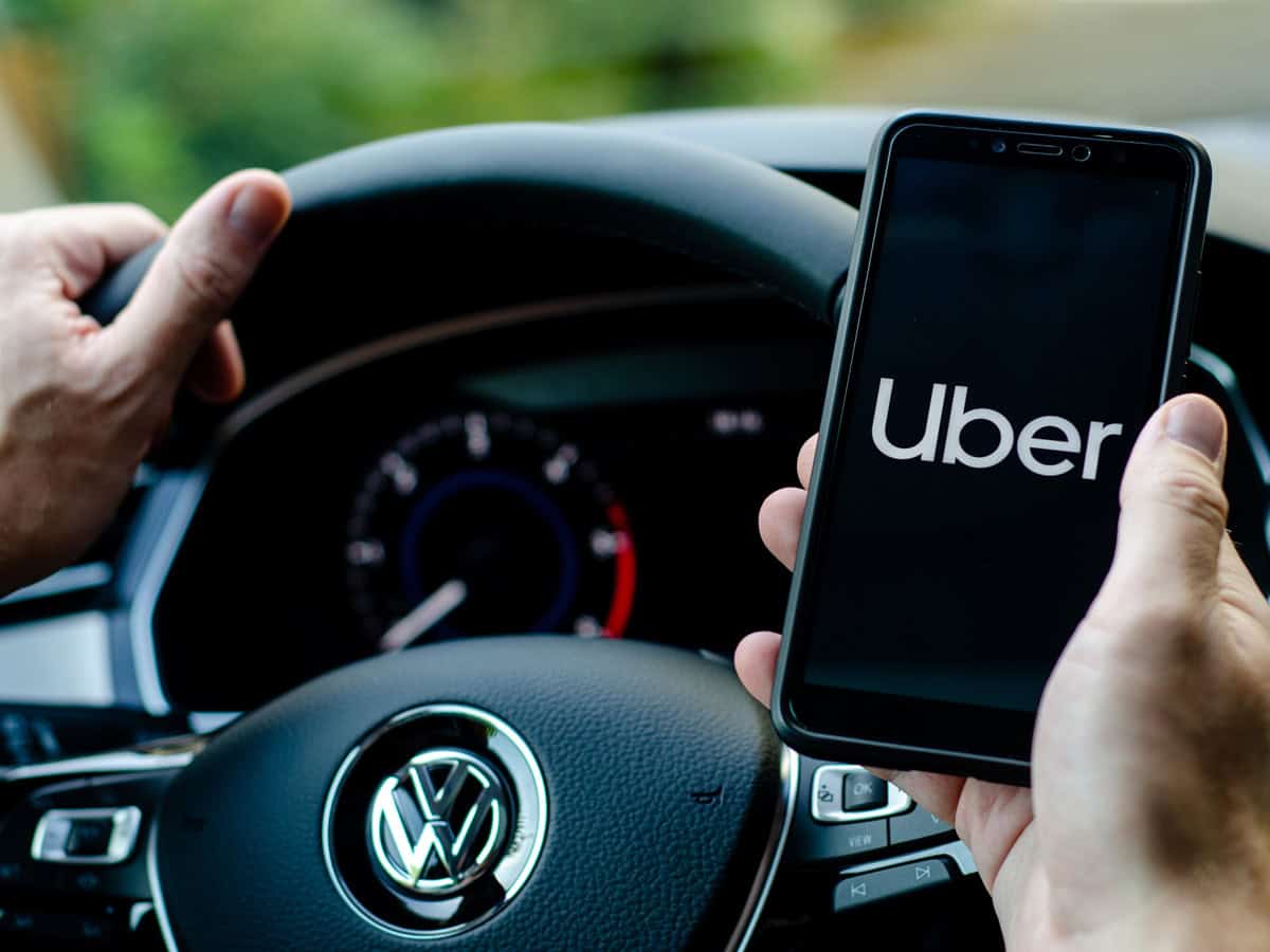
If you’re looking for a quick and private way to get around, taxis and rideshares like Uber and Lyft are always an option. They might cost a bit more, but they’re great for reaching places not covered by the bus or trolley.
| Transportation | Primary Areas Served | Route & Maps | Fee |
|---|---|---|---|
| StarMetro Buses | Downtown, various campuses, neighborhoods | StarMetro Routes | Paid at buses, online |
| Dial-A-Ride (StarMetro) | Door-to-door service as requested | N/A | Paid per ride |
| Tallahassee Downtown Trolley | Downtown major spots | N/A | Free |
| Taxis and Rideshares (Uber, Lyft) | City-wide as requested | N/A | Paid per trip |
Fort Lauderdale Public Transportation
The heart of this city's transportation beats with the Tri-Rail, a vital commuter rail that smoothly connects Miami, Fort Lauderdale, and West Palm Beach.
It's perfect for coastal sightseeing without the stress of driving. With 18 stations along the route, you can stop at various points of interest.
If exploring by bus is more your style, the Broward County Transit (BCT) is at your service. The fleet reaches over 400 square miles and is the area's most extensive public bus network. The BCT service is renowned for its efficiency, making it a reliable choice for getting around.
You can also get on the Sun Trolley to navigate the city's streets and neighborhoods, offering a unique and local perspective.
Another fun option is the Riverwalk Water Trolley, which provides a free picturesque journey along the New River. It stops at eight major spots, including Riverfront Plaza and Esplanade Park, perfect for sightseeing and snapping beautiful waterfront photos.
If you prefer cycling, Broward B-cycle lets you rent bikes from numerous stations, particularly around the beach and downtown.
| Transportation | Primary Areas Served | Route & Maps | Fee |
|---|---|---|---|
| Tri-Rail | Miami, Fort Lauderdale, West Palm Beach | Tri-Rail Routes | Paid at stations |
| Broward County Transit (BCT) | Fort Lauderdale and Broward County | BCT Routes | Some routes are free, others paid on board |
| Sun Trolley | Fort Lauderdale neighborhoods, Beaches, Las Olas Boulevard | Sun Trolley Routes | Some routes free, others paid on board |
| Riverwalk Water Trolley | New River, Downtown Fort Lauderdale | Water Trolley Map | Free |
| Broward B-cycle | Downtown, Fort Lauderdale Beach | B-cycle Stations | Paid at bike stations |
Pensacola Public Transportation
Your go-to for getting around Pensacola is the Escambia County Area Transit, or ECAT for short. These buses, with routes crisscrossing the city, are economical and convenient.
You'll find a range of bus routes that cover most of the city. ECAT's Route 64, known as the "Beach Jumper," is worth noting. It's your direct link to white sandy beaches and the Naval Air Station Pensacola.
For something different, take a ride on the Pensacola Bay City Ferry. This service lets you enjoy a scenic trip between Downtown Pensacola, Pensacola Beach, and the Gulf Islands National Seashore at Fort Pickens.
If you’re visiting during the summer, don’t miss the Pensacola Beach Trolley, a free seasonal service that runs along the beachfront, stopping at popular spots along Santa Rosa Island from May through September.
Lastly, rideshare options like Uber and Lyft are available throughout Pensacola, offering a quick and personal way to get wherever you need to go. Just download their app, set your pickup and drop-off locations, and a car will arrive.
| Transportation | Primary Areas Served | Route & Maps | Fee |
|---|---|---|---|
| ECAT Buses | Citywide including Pensacola Beach and Naval Air Station | ECAT Routes | Paid on board, passes available online |
| Pensacola Bay City Ferry | Downtown Pensacola, Pensacola Beach, Fort Pickens | Ferry Service Info | Paid at terminal |
| Pensacola Beach Trolley | Pensacola Beach | Trolley Routes | Free |
| Uber/Lyft | Throughout Pensacola | N/A | Paid via app |
Sarasota Public Transportation
In Sarasota, the SCAT offers extensive bus services covering the entire county, including key routes like Route 99 along US 41 from Palmetto to Venice and Route 14 from Sarasota-Bradenton International Airport to downtown.
If you’re on Siesta Key, hop on the Siesta Key Breeze Trolley. This free service runs from Siesta Key Village to Turtle Beach, and it's a laid-back way to explore the area.
In downtown, i-Ride Sarasota shuttles you around in golf-cart-like vehicles that are fun and eco-friendly. They mainly run through major spots downtown for quick hops. It’s practically free—you just tip the driver.
Lastly, Uber and Lyft are readily available for quick and direct trips anywhere in the city.
| Transportation | Primary Areas Served | Route & Maps | Fee |
|---|---|---|---|
| SCAT Buses | Sarasota County, including Venice, North Port, Keys | SCAT Routes | Paid on board, passes available online |
| Siesta Key Breeze Trolley | Siesta Key Village to Turtle Beach | Trolley Routes | Free |
| i-Ride Sarasota | Downtown Sarasota | i-Ride Info | Tips appreciated |
| Uber/Lyft | Throughout Sarasota | N/A | Paid via app |
West Palm Beach Public Transportation
Finally, we can't forget the "Orchid City," West Palm Beach, Florida. Here, the go-to service is the Palm Tran, offering a network of fixed-route buses that crisscross the county.
Whether it’s cruising along US 1 from Boca Raton to major attractions or hopping between cities from Palm Beach Gardens to downtown, Palm Tran connects you efficiently.
But, if your travels take you between West Palm Beach, Miami, and Fort Lauderdale, the Tri-Rail is your best bet. It's perfect for skipping the traffic and enjoying a relaxed commute.
The West Palm Beach Station places you conveniently within reach of downtown’s vibrant scene and the Palm Beach International Airport.
Brightline (now Virgin Trains USA) offers high-speed train services connecting West Palm Beach with Miami and Fort Lauderdale for a faster, more luxurious trip.
The free Downtown Trolley also services Downtown West Palm Beach. It has three lines (Green, Yellow, and Blue) that make stops at major attractions and neighborhoods. It’s totally free and runs frequently, making it ideal for quick hops around town.
Lastly, if you're looking for flexible and quick transportation, Uber and Lyft offer rideshare services all over West Palm Beach for direct and personal travel.
| Transportation | Primary Areas Served | Route & Maps | Fee |
|---|---|---|---|
| Palm Tran | Palm Beach County including Boca Raton, Palm Beach Gardens | Palm Tran Routes | Paid on board, passes online |
| Tri-Rail | Miami, Fort Lauderdale, West Palm Beach | Tri-Rail Routes | Paid at stations |
| Brightline | West Palm Beach, Fort Lauderdale, Miami | Brightline Routes | Paid online or at stations |
| Downtown Trolley | Downtown West Palm Beach | Downtown Trolley Info | Free |
| Uber/Lyft | Throughout West Palm Beach | N/A | Paid via app |
Practical Information for Travelers
Whether hopping on a city bus or taking a scenic train ride, the following insights will ensure a smooth journey through the Sunshine State.
Purchasing Tickets and Understanding Fares
Checking the fare structure for public transportation in Florida is essential to budgeting your travel expenses effectively. Each transit system has its own pricing, with options like single-ride tickets, day passes, or reloadable transportation cards.
For example, services like Miami-Dade Transit offer various ticketing options to fit your travel needs in Miami.
It's wise to research online or use dedicated apps to purchase tickets digitally, often allowing for discounts and convenience.
Seasonal Weather Considerations
Knowing what to expect each season is vital. Pack for heat and humidity during summer, while winters are generally mild and dry.
Keep an eye on the forecast during hurricane season, which runs from June to November, to avoid disruptions. Staying informed will ensure that you're prepared for the local climate, whether you visit the beaches or explore cities like Orlando.
Tips for Efficient Travel Throughout Florida
Crafting an unforgettable journey across the Sunshine State is all about smart planning. Here, you'll find a treasure trove of expert advice on making the most of Florida's public transportation system.
1. Prioritize Attractions Based on Location
You'll save time and energy by arranging your itinerary geographically. In cities like Miami, with its sprawling public transportation network, you can cluster visits to South Beach, Little Havana, and the Arts District on the same day.
2. Use Local Transit Wisely
In Orlando, the LYNX bus service covers a vast area. Understand the schedules and routes to ensure you catch your ride without delays. Timing is everything in a city full of theme parks and attractions.
3. Book During Off-Peak Travel Periods
Consider traveling during off-peak times to avoid crowds. For example, the SunRail commuter train in Central Florida is less busy outside rush hours, offering a more relaxed ride to your destination.
4. Take Advantage of Shuttle Services
Cities like Tampa offer free shuttle services in certain areas, such as the TECO Line Streetcar, which connects downtown with historic Ybor City, helping you easily navigate high-traffic spots.
5. Get Local Insider Tips
Scoop up valuable insights from locals or visit city visitor information centers for the inside scoop on public transit hacks that can save you time—like the best stops for quick beach access or shortcuts to popular venues.
Embrace these guidelines to streamline your transit across Florida, and watch as your travel becomes more about experiencing and less about waiting!